Over the course of the Living Levels project our amazing volunteers contributed countless hours to map the history of the Gwent levels. From the historical archives of the Court of Sewers and Census to the secrets of past land use hidden in the lidar data, we have explored and celebrated this amazing landscape providing new insights into the past.
Below are summaries of our projects with links to the resulting maps, we hope you enjoy reading about them as much as we enjoyed undertaking them.
- Mapping the 1830s Landscape
- Looking at Lidar in the Levels
- Who lived in here? Late C19th Farmsteads
- Linking Memory and Landscape – Oral History Locations
- Heritage on the Horizon
- Living Levels Celebration Storymap
Mapping the 1830s Landscape
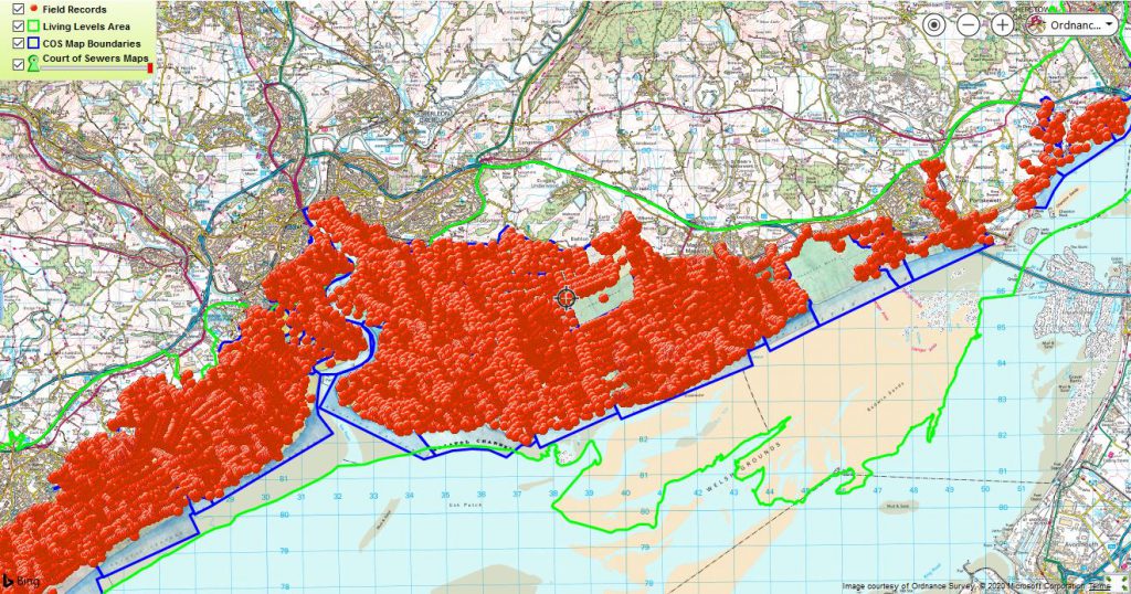
In late 2019 and early 2020 we hosted a citizen science project to give locations to thousands of field records from the Court of Sewers maps. The Living Levels RATS volunteers had painstakingly transcribed the records of who owned each field in the Levels in 1830, and we needed to add locations to these records so that we can make a searchable map.
In late march 2020 the mapping was completed, with extra ordinary efforts from volunteers Jeremy and Mike who between them mapped 99% of the locations needed. The searchable map is available here why not take a look?
Looking at Lidar in the Levels!
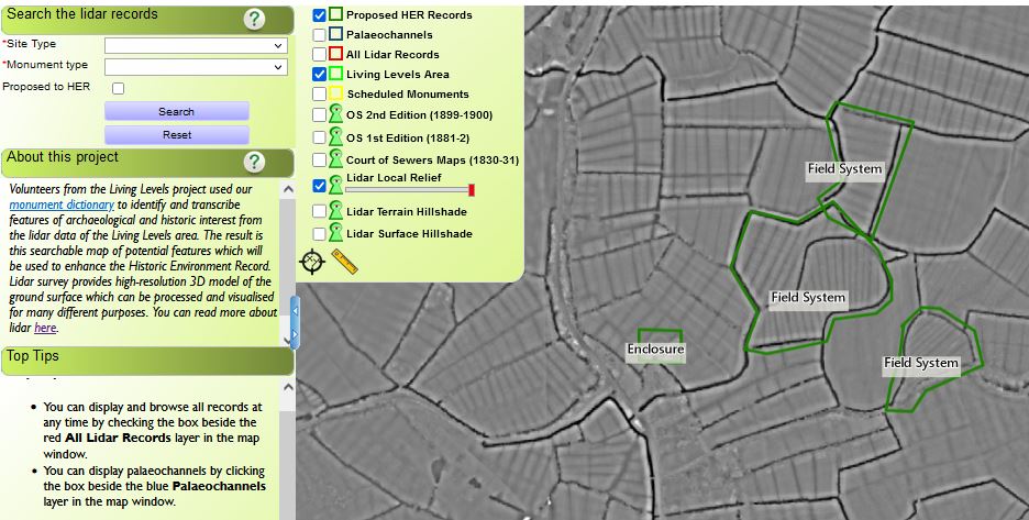
Our citizen science mapping project aimed to enhance the local historic environment record (HER) by completing the first full transcription of the lidar data for the Gwent levels. Lidar is a fantastic resource that allows us to identify many subtle surface features that remain as traces of past human activity in the landscape.
The project started strong in early 2020 with a brilliant training day and more than 40 initial feature transcriptions from Carol but had to be re-worked as the pandemic scuppered our plans for field verification of the features. After a long hiatus, four amazing volunteers, Mary, Mary, David and Brian took up the task completing the transcription in late 2021. Together these 5 volunteers mapped over 250 features, of which 190 have been reviewed as being new contributions to the existing record. The results can be viewed here.
Who Lived here? Late C19th Farmsteads
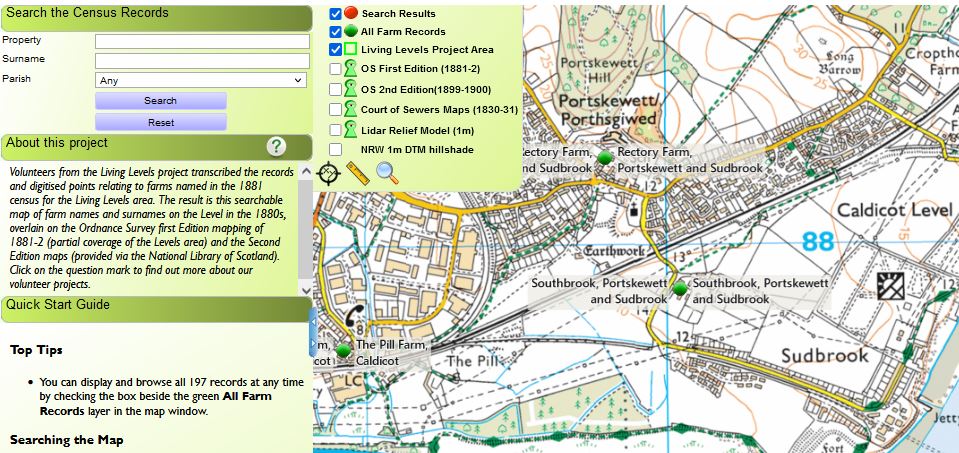
In a joint project with the RATS archival research group, dedicated volunteer Marion was able to map the locations of farmsteads across the levels transcribed from the 1881 census. The result is this incredible searchable map of 197 farmsteads which brings the census records to your fingertips.
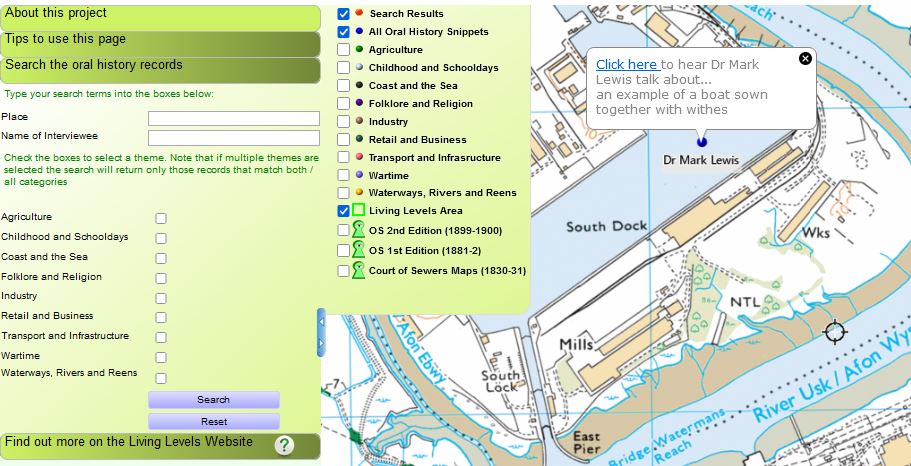
Linking Memory and Landscape – Oral History Locations
Volunteers from the Living Levels project selected interesting snippets from the interviews created by the oral histories project ‘Life on the Levels’. The result is a searchable map of voices talking about their memories of the Levels, overlain on the places they are speaking of, linking over 200 memories to the landscape.
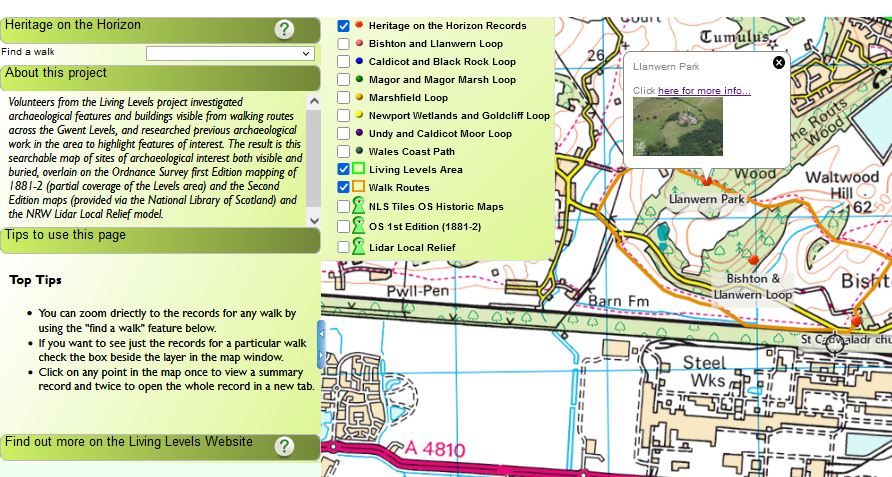
Heritage on the Horizon
Volunteers from the Living Levels project investigated archaeological features and buildings visible from the Loops and Links walking routes across the Gwent Levels, and researched previous archaeological work in the area to highlight features of interest. The result is a browsable map of sites of archaeological and historical interest both visible and buried.
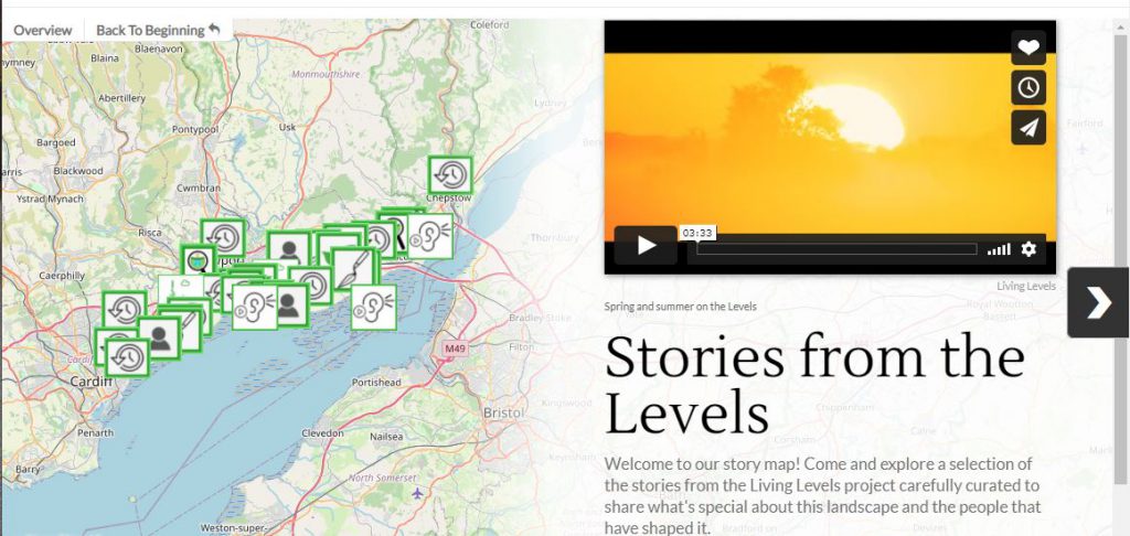
Living Levels Celebration Storymap
Our concluding project was another joint venture with the RATS archival research group and the Living Levels Project team creating a story map to collate and celebrate incredible stories from the project. With video, photos and incredible narratives, why not dive in and loose yourself for a while in the landscape and history of this special area.